Saturday, February 26, 2011

It's the End of the Highway!

This morning I was later than usual in leaving the campground. It had rained all night. I think there is something about a rainy morning that just makes you want to sleep in. It was 10 o'clock when I left Tok and it was drizzling. I felt sorry for these motorcycle riders who passed me. It can't be much fun riding in the rain.

To the west, the direction I was headed, the skies appeared to be clearing up a bit. To the east, gray, heavy clouds filled the sky. I hoped that Sue and Fred, who were a little more than a day behind, weren't getting a lot of rain.

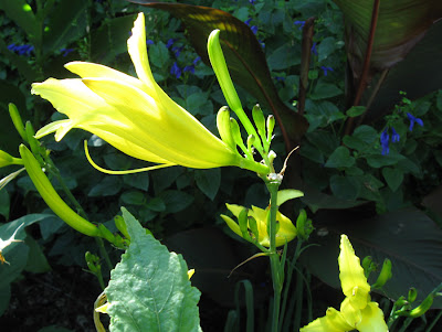
About ten miles west of Tok I glimpsed this pond out the side window. It took my breath away! I had to turn around and go back. It was just a few feet off the highway. There was no other traffic at the time and I felt as though I was alone with the universe. It was so incredibly beautiful.

The blue skies lasted another twenty minutes down the highway, then the gray stuff made it's way back. A little rain now and then too.

And then, a little over two and a half hours after leaving Tok, there it was. On a curve going into Delta Junction - the “official” end of the Alaska Highway. 1422 miles (nearly 2500 miles since leaving Roosville, Montana). At times it seemed like an endless highway; going up, down, curving around, seldom straight, but tree-lined with glimpses of far off vistas.

I made it! And in a few weeks, I'll have to do it again (at least part of it).

I've been in touch with Sue and Fred along the way. They are a little over a day behind me but we'll meet up on Sunday at Denali National Park. It has been rather comforting, in an odd sort of way I suppose, to know that they were following me. Knowing that they would be along if something happened along the way.

Just before they left Louisiana, Sue started a blog - Notes from the Cabin....and beyond in which she has been chronicling their fall trip. Sue and Fred are what you might call “planners” which is a somewhat different approach to my method of travel. They have had better internet access than I have and Sue has written much more than I have too – and written quite well, I might add. You might enjoy reading what she has to say about their journey...

I'm currently at the very pleasant public library in Delta Junction, immensely enjoying their fast wifi. Shortly, I will be heading north towards Fairbanks. The Tanana Valley State Fair starts today in Fairbanks so I'm a little concerned with finding a place to stay and may stop just before getting to Fairbanks, making it one of the shorter drive-days. I considered taking the Denali Highway over to Denali but it is a gravel road and it has been raining so it can be a bit slippery. Besides I need to refill my cooler and cupboards as I've eaten nearly everything I brought! So toward Fairbanks I'll be heading.

Photographs taken August 6, ...

Thursday, February 24, 2011

Rutland Round 5 - Normanton to Clipsham

With Marta. Fine, sunny, but cold to start with. Some mud underfoot. Luckily I remembered the way through Clipsham Quarry. Only other small problem was on the way to Tickencote where we missed a turn to the right, but were able to correct easily. Lunch at The Plough in Great Casterton. 14 miles including walk to Yew Tree Avenue.


An early morning shot before leaving one car here


The first two miles from Normanton Car Park on Rutland Water were very simple - follow the yellow brick road, well, the tarmac path, past the café, past Normanton church and the back entrance to the Normanton Park Hotel, and carry on across the dam. Blue sky, blue water, and a chilly north wind. A few cyclists, loads of sheep and the guys inflating those see-through balloons you can be strapped in to roll down the grassy slope behind the dam.


Instead of going through the gate at the end of the dam path, we followed the field edge round, almost turning back on ourselves. We walked along the edge of the wooded area, and shortly after a couple of trig points, or similar objects, there was a stile on our left which led into a field. We spotted the Rutland Way signs for the first time today - and on the stile.


Ten out of ten for clarity!

The signs were easy to follow from this point, leading over fields and through some woodland, until the path emerged into Nook Lane in Empingham. Nook Lane leads to the main A 606. We crossed over to walk past the White Horse pub and along the road through the village. The church was down a small road to the right as we walked straight on.


Just after the end of the village, very soon after Mill Lane, the footpath goes away from the road, up through a short stretch of woodland - Chapel Spinney. A little further along the road after the turn there's a convenient bench for our first stop of the day - a little chilly in the shade, so we didn't linger longer than the few minutes needed to top up the caffeine level.


The path came out of the trees into sunshine and continued along the top edge of several fields. Empingham was now a cluster of houses and the church behind us. We passed a spinney on the right, and continued to follow the path. There may be a waymarker that we missed, but we fought our way thorugh an overgrown section and came out on the concrete path leading towards Tickencote Lodge Farm. We had just walked round the two sides of a triangle instead of the hypotenuse - give or take the accuracy of the right angles.


Tickencote Lodge Farm

We turned right and walked down the track until we met the Rutland Round waymarker pointing back to where we should have walked. Close by was a stile into the next field of recently cut hay, which we crossed diagonally (just south of east) to the next yellow post just before another farm house.


We followed the signs round the house and on to a small road north east for a short distance, before entering a couple of fields and walking in the same direction, the turning slightly to the right.


Tractor tedding hay near Tickencote

We crossed another small road towards Tickencote Hall, and had to brave this signposted danger:


He seemed to be dozing in the shade and showed no interest in us.


Looking towards Tickencote Hall

The path goes past the church of St Peter, which is small but impressive. It was restored at the end of the eighteenth century, but is considered a fine example of a Norman church.


The vaulting


The chancel arch


The East End of the church

We walked through the village to a sign and short section of path which crosses a field, then emerges on to a road near the OK Diner, then goes under the A1 and into Great Casterton. The Plough Inn is right on the route and provided an adequate, though not perfect lunch, with exceptionally friendly service from its new landlord.


Chatter, imperfect map-reading and inattention to the book's instructions almost set us off on the wrong road after lunch - and all on fruit juice at that.


You need to walk along to the junction with the Pickworth road, and turn left past the primary school - or take the narrow lane between houses just before the school sign on the main road. In any case take the road out of Great Casterton past the school and walk along this for a good mile until you reach Mounts Lodge Farm. Opposite here a bridleway leads to the left - almost due west. The path was pretty muddy - puddle-dodging skills honed while you walk.


After a few hundred yards, at the end of the first very big field, we turned right along a grassy track. We continued along this, ignoring any tracks to the right or left, and made our way more or less north towards Pickworth. The signing around here is pretty poor. Just opposite the point where the path meets the road is this medieval arch.


Photograph from 24.11.


The arch, on private land is all that remains of a church from the 12th, 13th or 14th century.


The remains of a lime-kiln, where John Clare worked for a while as a lime-burner. - 18.11.


The lime-kiln is also on private land, and almost invisible in the summer.

We turned left along the road, and walked past the first footpath sign near Manor Farm, and past the limekiln, to find the path we needed, which goes off to the right at a bend in the road. Time for another coffee-break, before tackling the remaining three or four miles.


The path is wide and clear, and we had no trouble finding the point where we turned right across a field towards a strip of woodland marked as Little Sutie on the map. Through this was where I had wandered last time i walked here. The map shows the path diverging slightly from the wood on the right hand side. This time we followed the edge more closely and we found the path through the quarry with no difficulty. Once at the quarry the bridle way is clearly posted.


Clipsham Quarry 24 Nov

The path from the quarry towards Clipsham provided a few earlyish blackberries today. No problems following the route from here as for most of the way it runs between hedges, and the village is clearly visible.


We walked along the Castle Bytham road for about a mile to get back to the Yew Tree Avenue. Fourteen miles on the clock today.


Sunny

Sunny is our oldest horse. We think he is around 25 years. He would eat us out of house and home if we would let him. He thinks we should feed him 24 hours a day. And grumbles when we don't and when we do. We feed him what the vet says to feed him. He has a big belly but his backbone shows. Vet says we need to re-arrange his body. Says he needs more excersise to do that. But I find it hard to excersise me or the horses when it is as hot as it has been this summer. But we are going to start trying to do more. In the mean time Sunny thinks his retirement is going great. he is a sweet old horse, who loves to be petted, groomed and bathed. I bet he was one heck of a horse when he was young. I don't know anything about who had him or what his life was like then. He and my QH mare, Nita, are best friends.


Wednesday, February 23, 2011

Travelin' thru Tennessee


As I left Indiana on Sunday morning, I wasn't too concerned with what the weather was doing in Kentucky and Tennessee. According to reports, the ice and snow would have finished falling before I got there. And the reports were right, but it sure did leave a "mess" all along the I-40 corridor from Oklahoma to the Carolinas and Virginia. Interstate 65 was clear all the way but through Nashville the exit and entrance ramps were in horrible shape and from what I saw on the news many of the secondary roads were still snow covered and icy this morning.

When I left Nashville yesterday morning, the sun was shining brightly and blue skies abounded. In the aftermath of the winter storm, Mother Nature left behind a wonderland of ice coated trees, grass, and bushes. These photos were taken as I was driving on I-65 between Nashville and Columbia on Monday morning. The bottom photo was taken through the (very dirty, salt coated) driver's side window. Once over the mountains and south of Columbia, there was no ice or snow and the temperature was a balmy 50 degrees. Nice.

Sunday, February 20, 2011

Wiley Cat

Wiley Cat and Tuffee Dog keeping watch on the garden.


A Sign of Summers End

Nature provides us with many signals that the end of summer is near. One of those signals is the fireweed - when the top buds blossom forth and the plant goes to seed.


Friday, February 18, 2011

In a Box


You big bully. You can't get me while I'm in my box.

Tiger Lily


Tiger Lily, originally uploaded by ParsecTraveller.

A spotted tiger lily in the John Muir Wilderness near Big Pine, California. The John Muir Wilderness is excellent for hiking - lakes, streams, waterfalls, forests, desert, and even glaciers!

Tuesday, February 15, 2011

Mesa Verde :: Cliff Palace

It would probably seem to be a good bet that from Hovenweep I would go to visit the “cliff dwellers” at Mesa Verde National Park, located near Cortez, Colorado and about 50 miles east of Hovenweep. The park contains over 4,000 known archeological sites including cliff dwellings and the mesa top sites of pithouses, pueblos, masonry towers, and farming structures although many of them are not accessible to the everyday visitor.

The first stop was the campground. Even though I was assured by the Ranger at the entrance station that the campground never fills up, I wanted to make sure that I had a site for the night. After securing my site I drove the dozen or so miles winding up the mountain side to the visitors center. A ticket, for the nominal sum of three dollars, is required to tour the cliff dwellings. The number of visitors on each tour is limited as are the number of daily tours to each site. There were several slots available for the two dwelling sites that were open – Cliff Palace and Balcony House – and I obtained tickets for Cliff Palace that afternoon and Balcony House the next morning.

There are signs posted at the waiting area for the tours warning that “Visiting the cliff dwellings will involve strenuous hiking and climbing. If you have any health problems do not attempt.” Dire warnings, indeed. But the trail is only a quarter of a mile long. How difficult could it be?

A portion of the Cliff Palace seen from the top of the trail. A large part of the dwelling is off to the left and much of it is barely visible in the shadows.

Several of the towers are four stories high. Park literature states that “The cliff dwellings of Mesa Verde are some of the most notable and best preserved in the North American Continent. Sometime during the late 1190s, after primarily living on the mesa top for 600 years, many Ancestral Puebloans began living in pueblos they built beneath the overhanging cliffs. The structures ranged in size from one-room storage units to villages of more than 150 rooms. While still farming the mesa tops, they continued to reside in the alcoves, repairing, remodeling, and constructing new rooms for nearly a century. By the late 1270s, the population began migrating south into present-day New Mexico and Arizona. By 1300, the Ancestral Puebloan occupation of Mesa Verde ended.”

And, “Recent studies reveal that Cliff Palace contained 150 rooms and 23 kivas and had a population of approximately 100 people. Out of the nearly 600 cliff dwellings concentrated within the boundaries of the park, 75% contain only 1-5 rooms each, and many are single room storage units. If you visit Cliff Palace you will enter an exceptionally large dwelling which may have had special significance to the original occupants. It is thought that Cliff Palace was a social, administrative site with high ceremonial usage.”

It was fascinating. And the trail really wasn't so bad. A metal stairway leads to a series of uneven stone steps of varying heights. Then the path goes along the edge of the cliff making its way around to a 10-foot ladder going up to the next level. From there, you had to go back down a ways along a stone and dirt path finally reaching the area of the cliff dwellings.


The park Ranger preparing to climb the last of the ladders back to the top.

At first glimpse, and from a distance, the final ladder climb looks scary. This was taken from the trail waiting area before going on the tour. But, as you can see from the previous photo, the ladder hugs the wall and it was a relatively easy climb.

Monday, February 14, 2011

Hale Brubaker & Crow's Corner School


Maurice Hale Brubaker (known as Hale) was the youngest son of Malissa Joslin and William Brubaker. He taught at least one term at the Crow's Corner school in Smith Township, Whitley County, Indiana when he was 18 years old. This was still at a time when college degrees were not required for teaching.

Hale's life was cut short when just 6 years later he died of pneumonia while attending Law School at Columbia University in New York. His death had a traumatic affect on the family. It was a shock to his parents but particularly his father who died a little over a year later.

The brief "biography" of Hale was written by his mother: "Hale died in N Y Dec 14 1910 aged 24y 6m & 27da he was in Columbia University a Law Student would have finished in May 1911 he was born in Troy TP Whitley Co graduated in common School when 13 & in high School 17 Taught School in Smith TP. was an active member in the First Baptist church & Sunday School after all God took him called him higher where he is at rest Mother"

I'll be posting more about Hale in the future...

The Pupils listed on the Souvenir tag are:
  • Grade VII: Chester McNeal, Thomas Griffith, Etta Rowland, Bessie Gordon, Katie Fulk, Dessie Garrison
  • Grade V: Ethel Herron, Jennie Gilbert, Rilla Boggs, Edward Gordon, John Fulk, Charles Gilbert, Jesse Rowland, Earnest McNeal, Herbert McNeal, Cyrus Griffith, Joshua Griffith
  • Grade III: Lottie Herron, Virgie Griffith, Frank Garrison, Howard Gilbert
  • Grade I: Opal Boggs, Millie Garrison, and a few more that were in the damaged portion

Sunday, February 13, 2011

Imagining Dad In the Garden

Annieinaustin, Blue River HibiscusIt's a dozen years since my dad died but he was with me in imagination as I mowed and wandered around the garden today. He loved our Illinois garden and if he were here he'd recognize these first 10" blooms as the Blue River II Hibiscus. Annieinaustin,hemerocallis citrinaDad would know the Citrina daylily. A neighbor shared it with me in 1978 and it's bloomed in four of our gardens. Annieinaustin, purple calibrachoaDad disliked purple clothes but liked purple flowers so this basket of Calibrachoa might get a nod of approval. Even if the visit is imaginary I'd better do something about the tree saplings sprouting in every shrub and flower bed. That was one of Dad's pet peeves. Get that pecan out of the hydrangea! There'd be no excuse for not weeding once Dad saw the Cobrahead tool Anneliese sent me for winning a contest on the Cobrahead blog. And he he might be amused that the winning plant ID was Horseradish, something he grew near his picnic table. Annieinaustin, praying mantisIf we were lucky we could catch a glimpse of the small Praying Mantis hanging upside down on the Meyer's Lemon. Annieinaustin, Carmello tomato We could taste the first 'Carmello' tomato - a new one this year. Under bird netting some 'Early Girl' tomatoes are coming along and so are a cluster of 'Costoluto Genovese'. Annieinaustin, Costoluto genoveseWith so few tomatoes we'd have to use canned tomatoes for spaghetti sauce. In my mind I hear him say, "getting a little heavy handed with the oregano, aren't you, missy?" He'd be okay with lots of basil, I think...not being Italian never stopped my dad from cooking old-time Chicago Italian dishes - pounding round steak thin, rolling, filling and tying it to make Brachiole in red sauce. With maybe some zucchini sliced, dipped & fried in olive oil on the side.


I can't even imagine what kind of conversation we could have about the non-garden world - my father was a pipefitter at a Fisher Body plant, the division of GM that made car bodies. Every news broadcast this week has made me wonder how my parents would have felt about the whole thing.


What would he think about part of his family living in Texas?Annieinaustin, soldiers in New Guinea, WW2Dad learned to hate Texas weather when stationed here on manouvers prior to shipping out for 3 years in New Guinea during World War II.

Forty years later he learned to dislike Texas highways and their primitive rest stops when he & Mom drove IH35 all the way through Texas to San Antonio one hot September. But like most guys - once he got to the reunion of old army buddies, he had a great time.
Miss you, dad!